Jharia coalfield · Jharkhand, India

The ground under Jharia has been burning since 1916.

Underground coal fires crack and sink the land that people live, work and drive on. Fire Watch follows every one of them from space, and closes a road before a fire reaches it.

Scroll
The mission

A fire you can't see is still a fire. Every 8 days a Landsat satellite crosses Jharia. Every fire gets followed, and every road above one gets a decision, with a person in charge whenever it matters.

Women carrying baskets of coal up from a pit
Carrying coal up from the pitBusiness Insider
Three workers eating a meal on a coal heap
A meal break on the heapsAP via Al Jazeera
A line of women carrying coal baskets on their heads past an open-cast mine
Walking out of an open-cast mineiStock via Down To Earth
Three coal gatherers sitting with empty baskets
Gatherers between loadsBBC Future
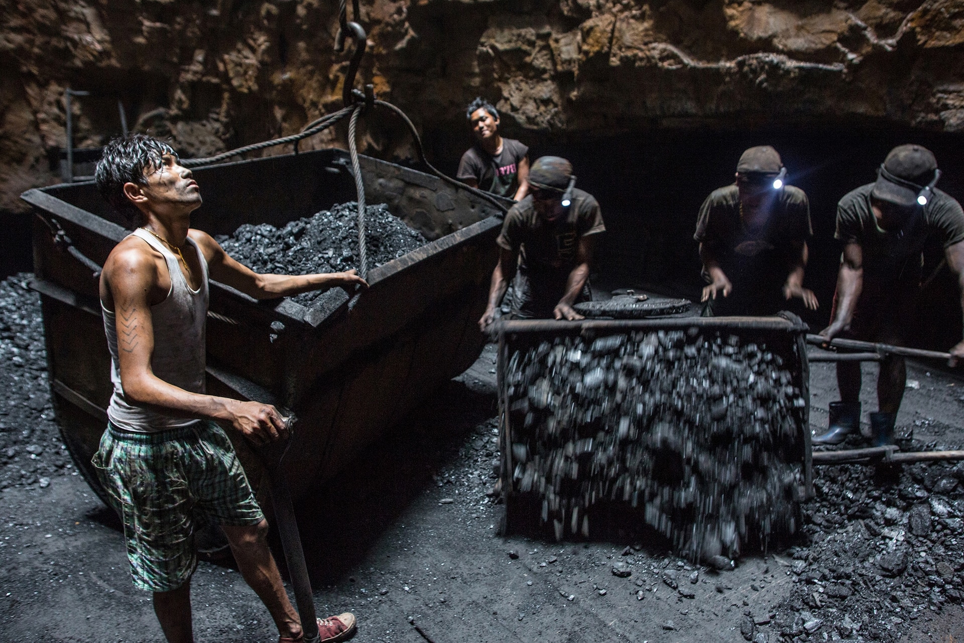
Miners loading coal tubs underground
Loading tubs undergroundRobb Kendrick, National Geographic
Miners in helmets pushing a coal tub
Pushing a loaded tubMint
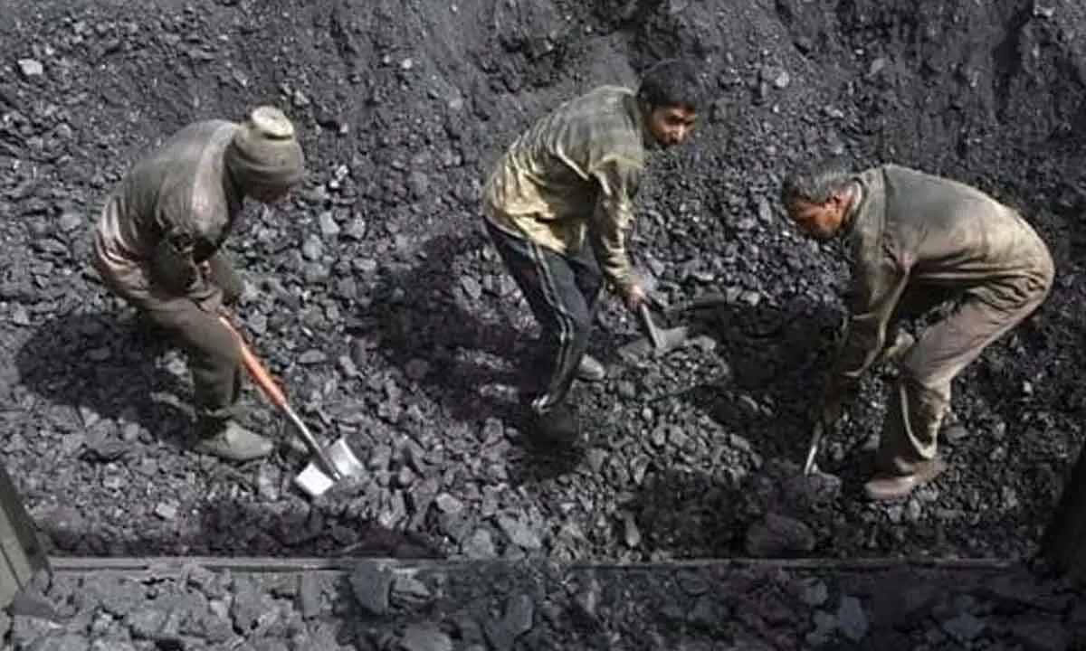
Workers shovelling coal
Shovelling at a loading pointThe Hans India

Photos belong to the publishers credited and are shown from their own sites.

How it works

From a satellite photo to a safer road.

Step 1 of 8

01

A satellite photographs the coalfield

Every 8 days Landsat 8 or 9 passes over Jharia. Fire Watch reads only the coalfield window of each scene: the heat band, six colour bands and the cloud mask, about 10 to 13 MB a pass.

  • Landsat Collection 2
  • ST_B10 heat band
  • QA_PIXEL cloud mask
  • USGS new-scene alerts

Output A fresh heat image and colour photo

02

Heat becomes temperature

Band 10 is turned into land-surface temperature: radiance, then brightness temperature, then a correction for how much heat the surface gives off, estimated from its vegetation. Cloud, shadow and water are masked so they can't fake a fire.

  • Brightness temperature
  • NDVI emissivity
  • Cloud, shadow & water mask

Output Surface temperature, within 0.10 K on test data

03

Every photo lined up with the last

Each pass is aligned to a reference so the same patch of ground is compared every time. SIFT aligns it, ALIKED with LightGlue on OpenCV 5's new DNN engine aligns it again on its own, and DISK settles any disagreement around a hotspot.

  • SIFT + USAC_ACCURATE
  • ALIKED + LightGlue
  • DISK
  • OpenCV 5

Output Passes aligned to within half a pixel

04

Hot ground found, false alarms filtered

Dark coal and bare dumps warm up in the sun, so that heat is regressed out against brightness and vegetation. What's left is compared with the local background, and hysteresis and contours outline each hotspot. Coke ovens and other industrial heat are recognised and ignored.

  • Albedo & NDVI regression
  • Hysteresis thresholds
  • OpenCV contours
  • Industrial mask

Output Hotspots, with precision 1.00 on both test worlds

05

Each fire followed and projected

Hotspots are joined into tracks from pass to pass. Optical flow measures how the hot front moved since the last pass, and an advection–diffusion ensemble projects where the fire could reach in the next 48 days.

  • Track matching
  • DIS optical flow
  • 48-day spread cone

Output A spread cone covering 92% of the ground a fire went on to burn

06

Risk, confidence and precedent

Every hotspot gets a risk score from its heat, its spread and how close it is to a road, plus a score for how sure the system is. Similar past fires, found with OpenCV's nearest-neighbour index, show how fires like this one behaved.

  • Risk score
  • Confidence score
  • cv2.ANNIndex precedent

Output High, medium or low risk, and how sure it is

07

The agent decides, a person stays in charge

The agent closes a road within 250 m of a fire on its own only when risk is high and it is at least 70% sure. Fires half under cloud, threats seen only in the projection and anything it can't confirm go to a person with a recommendation. After two quiet passes it proposes reopening, and only a person can reopen a road.

  • Close a road
  • Ask a person
  • Propose reopening
  • LangGraph agent

Output Matched a safety officer's call in 35 of 36 test situations

08

Everyone sees what changed

Closures and decisions appear on the dashboard and the public road-status list, with every step the agent took and why. Alerts go out through AWS, and every map layer carries a record of where it came from.

  • Dashboard
  • Public road status
  • SNS alerts
  • S3 + DynamoDB
  • XMP provenance

Output Safer roads over a burning coalfield. Read the full explanation

Live from orbit

Underground coal fires, watched from space.

Fire Watch checks every Landsat photo of the coalfield, follows each fire from pass to pass and keeps the roads above them safe.

The coalfield in the latest photo

Drag the line to compare the ordinary photo with the heat image from the same satellite pass. Each ring is a fire Fire Watch is following.

Check a place

Type a town, mine or road to find the nearest fire and whether a road there is closed.

Try it: you set the fire, Fire Watch decides

Move the sliders to change an underground fire, and watch the agent's decision change in the 3D coalfield. It uses the same scores and safety rules as the real system. Bring a hot fire within 250 m of the road and see what happens to the people and trucks on it when the road stays open, and when it closes.

Keeps watchingNot a danger to a road right now.
Try:
Risk0.42 medium
lowmediumhigh
How sure it is100%
enough to act alone

See it in one minute

From a satellite pass to a closed road, and back. An animated walk-through of what Fire Watch does on every photo.

Dhanbad–Jharia road Haul road H2 Coke ovens Village Open-cast mine Fire 6 Factory heat: ignored 218 m to road ! Reopen haul road H2? Fire 6 has stayed quiet for two photos in a row. Yes, reopen Keep closed Landsat 9 · 23 Dec 2025 Fire Watch Every 8 days. Every fire. A person always decides to reopen.
1 / 6Every 8 days, a Landsat satellite photographs the Jharia coalfield.
0:00

    What brings you here?

    Pick the one that fits. Only the dashboard needs a sign-in.

    Setting it up on your own computer? See running it with real data. Something not working? See troubleshooting.

    Road status now

    Roads closed because an underground fire is close to them. A closed road reopens only after a person checks it.

    Loading
      Road names come from OpenStreetMap. Section codes such as R2-04 mark about 400 m of road.

      Why a fire under the ground closes a road

      Jharia's fires burn in coal seams below the surface. You can't see the flames, but the ground above them gets hot, cracks and sinks.

      Cross-section of the ground under a road A burning coal seam below a road leaves empty space as it burns. The rock above sags into the gap and the road surface sinks and cracks. Coal seam Road Rock above the seam

      How much of Jharia is burning

      Fire area mapped from satellite heat images by the National Remote Sensing Centre (NRSC)

      • 20098.9 km²
      • 20173.28 km²
      • 20201.89 km²

      The mapped area has shrunk as burning coal is dug out, covered or flooded. What is left still lies close to roads, railways and homes.

      Source: NRSC figures in BCCL's Jharia fire report.

      Safer roads over a burning coalfield.

      About the data

      Everything on this site comes from free, public sources. Here is what they are and where they fall short.

      Satellite photos
      Landsat 8 and 9 Collection 2 Level-2 scenes (USGS), read from Microsoft Planetary Computer. Each pass brings a surface temperature image and an ordinary colour photo.
      Heat image
      Landsat measures heat at 100 m and USGS delivers it on a 30 m grid. Fire Watch looks for ground at least 8 °C hotter than its surroundings once sun-warmed coal and bare ground are accounted for.
      Roads, mines and plants
      OpenStreetMap. Roads are cut into sections of about 400 m so a closure can be precise.
      Fire area history
      NRSC fire maps for 2009, 2017 and 2020, as published by BCCL.

      What it can't do